Old Boundary Marker by the A40, London Road, Knave's Beech
Introduction
The photograph on this page of Old Boundary Marker by the A40, London Road, Knave's Beech by Milestone Society as part of the Geograph project.
The Geograph project started in 2005 with the aim of publishing, organising and preserving representative images for every square kilometre of Great Britain, Ireland and the Isle of Man.

There are currently over 7.5m images from over 14,400 individuals and you can help contribute to the project by visiting https://www.geograph.org.uk
Old Boundary Marker by the A40, London Road, Knave's Beech
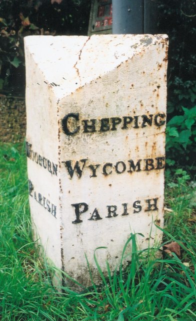
Image: © Milestone Society Taken: Unknown
Parish Boundary Marker by the A40, in parish of Chepping Wycombe (Wycombe District), Knave's Beech; between Hedley View cul de sac and Links View bungalow, on well kept grass verge behind path, West side of road. Inscription reads:- : WOOBURN / PARISH : : CHEPPING / WYCOMBE / PARISH : Surveyed Milestone Society National ID: BU_LW25pb
Images are licensed for reuse under creativecommons.org/licenses/by-sa/2.0
Image Location
Latitude
51.604726
Longitude
-0.690616