Old Boundary Marker by the A67, Carmel Road South, Darlington
Introduction
The photograph on this page of Old Boundary Marker by the A67, Carmel Road South, Darlington by Milestone Society as part of the Geograph project.
The Geograph project started in 2005 with the aim of publishing, organising and preserving representative images for every square kilometre of Great Britain, Ireland and the Isle of Man.

There are currently over 7.5m images from over 14,400 individuals and you can help contribute to the project by visiting https://www.geograph.org.uk
Old Boundary Marker by the A67, Carmel Road South, Darlington
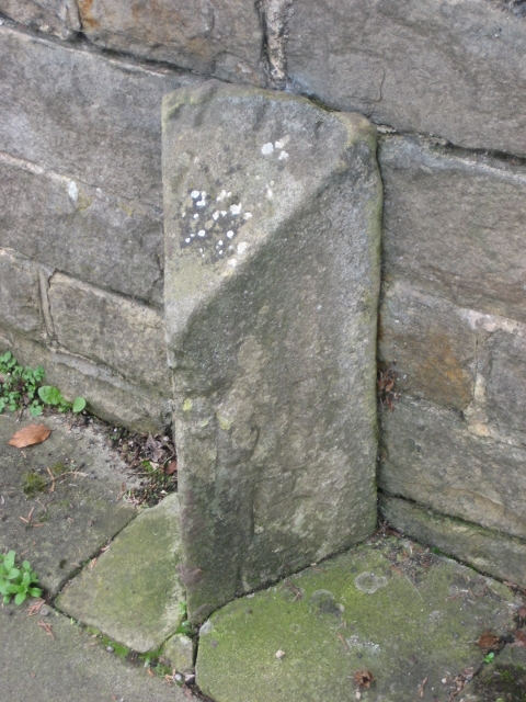
Image: © Milestone Society Taken: Unknown
Boundary Marker by the A67, in parish of Darlington (Darlington District), Carmel Road South, near Elm Ridge Methodist Church, against wall outside Greenways Mews. Surveyed Milestone Society National ID: DU_DAHLAbm
Images are licensed for reuse under creativecommons.org/licenses/by-sa/2.0
Image Location
Latitude
54.516351
Longitude
-1.578001