Old Milestone by the A6, Main Street, Shap
Introduction
The photograph on this page of Old Milestone by the A6, Main Street, Shap by CF Smith as part of the Geograph project.
The Geograph project started in 2005 with the aim of publishing, organising and preserving representative images for every square kilometre of Great Britain, Ireland and the Isle of Man.

There are currently over 7.5m images from over 14,400 individuals and you can help contribute to the project by visiting https://www.geograph.org.uk
Old Milestone by the A6, Main Street, Shap
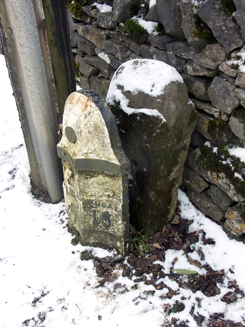
Image: © CF Smith Taken: 23 Feb 2010
Carved stone post by the A6, in parish of SHAP (EDEN District), Main Street, next to Fell House, East of Croft House, behind Milepost: WE_KDSP16 Image on West side of road. Old Shap stone, erected by the Heronsyke & Eamont Bridge turnpike trust in the 19th century. Inscription once read:- (Kendal) (16) Milestone Society National ID: WE_KDSP16a.
Images are licensed for reuse under creativecommons.org/licenses/by-sa/2.0
Image Location
Latitude
54.525872
Longitude
-2.674544