Old Boundary Marker by Lawns Corner, Higher Godsworthy
Introduction
The photograph on this page of Old Boundary Marker by Lawns Corner, Higher Godsworthy by Alan Rosevear as part of the Geograph project.
The Geograph project started in 2005 with the aim of publishing, organising and preserving representative images for every square kilometre of Great Britain, Ireland and the Isle of Man.

There are currently over 7.5m images from over 14,400 individuals and you can help contribute to the project by visiting https://www.geograph.org.uk
Old Boundary Marker by Lawns Corner, Higher Godsworthy
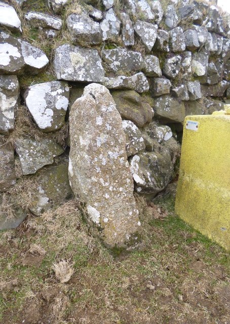
Image: © Alan Rosevear Taken: 13 Mar 2013
Parish Boundary Marker by the UC road, in parish of Peter Tavy (West Devon District), Lawns Corner where road bears North to Higher Godsworthy Farm, beside wall on verge at corner, next to Salt bin. Devon & Dartmoor HER. HER Number: MDV123107 https://www.heritagegateway.org.uk/Gateway/Results_Single.aspx?uid=MDV123107&resourceID=104 Surveyed Milestone Society National ID: DV_PTB02pb
Images are licensed for reuse under creativecommons.org/licenses/by-sa/2.0
Image Location
Latitude
50.573535
Longitude
-4.077635