Old Boundary Marker by the A4251, High Street, Berkhamsted
Introduction
The photograph on this page of Old Boundary Marker by the A4251, High Street, Berkhamsted by Milestone Society as part of the Geograph project.
The Geograph project started in 2005 with the aim of publishing, organising and preserving representative images for every square kilometre of Great Britain, Ireland and the Isle of Man.

There are currently over 7.5m images from over 14,400 individuals and you can help contribute to the project by visiting https://www.geograph.org.uk
Old Boundary Marker by the A4251, High Street, Berkhamsted
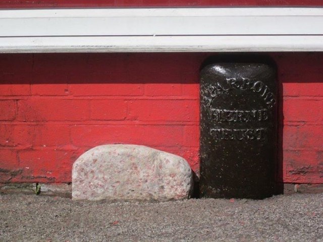
Image: © Milestone Society Taken: Unknown
Turnpike Terminus Marker by the A4251, in parish of Berkhamsted (Dacorum District), High Street at junction with Park Street, against wall of National Tyres and Autocare. Inscription reads:- SPARROWS HERNE TRUST Grade II listed. List Entry Number: 1422365 https://historicengland.org.uk/listing/the-list/list-entry/1422365 Surveyed Milestone Society National ID: HE_BESHt
Images are licensed for reuse under creativecommons.org/licenses/by-sa/2.0
Image Location
Latitude
51.762985
Longitude
-0.572074