Old Boundary Marker by Coombe Road, Saltash
Introduction
The photograph on this page of Old Boundary Marker by Coombe Road, Saltash by Milestone Society as part of the Geograph project.
The Geograph project started in 2005 with the aim of publishing, organising and preserving representative images for every square kilometre of Great Britain, Ireland and the Isle of Man.

There are currently over 7.5m images from over 14,400 individuals and you can help contribute to the project by visiting https://www.geograph.org.uk
Old Boundary Marker by Coombe Road, Saltash
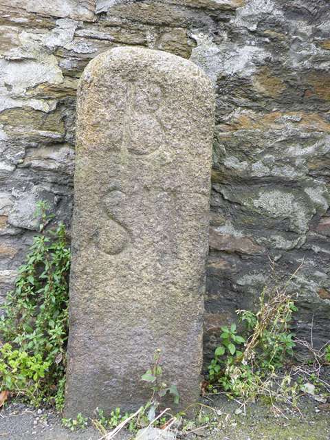
Image: © Milestone Society Taken: Unknown
Turnpike Terminus Marker by the UC road, in parish of Saltash (Caradon District), Coombe Road, junction with Culver Road, at base of tall stone wall between grit bin and telegraph pole. Inscription reads:- B S T (Boundary Saltash Turnpike) Cornwall & Scilly HER. HER Number: MCO57965 https://www.heritagegateway.org.uk/Gateway/Results_Single.aspx?uid=MCO57965&resourceID=1020 Surveyed Milestone Society National ID: CW_SHLK00t
Images are licensed for reuse under creativecommons.org/licenses/by-sa/2.0
Image Location
Latitude
50.406611
Longitude
-4.208979