Old Boundary Marker by Berry Head Nature Reserve
Introduction
The photograph on this page of Old Boundary Marker by Berry Head Nature Reserve by Milestone Society as part of the Geograph project.
The Geograph project started in 2005 with the aim of publishing, organising and preserving representative images for every square kilometre of Great Britain, Ireland and the Isle of Man.

There are currently over 7.5m images from over 14,400 individuals and you can help contribute to the project by visiting https://www.geograph.org.uk
Old Boundary Marker by Berry Head Nature Reserve
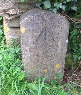
Image: © Milestone Society Taken: Unknown
Estate Boundary Marker by the UC road, in parish of Brixham (Torbay District), Berry Head Nature reserve, against wall end at T-junction, where Gillard Road bends towards Berry Head Hotel. Inscription reads:- ^ B O 3 (Board of Ordnance) Grade II listed. List Entry Number: 1195201 https://historicengland.org.uk/listing/the-list/list-entry/1195201 Surveyed Milestone Society National ID: DV_TQKW08aaem
Images are licensed for reuse under creativecommons.org/licenses/by-sa/2.0
Image Location
Latitude
50.395628
Longitude
-3.492508