Old Boundary Marker by the A672, Grains Bar on Oldham Road
Introduction
The photograph on this page of Old Boundary Marker by the A672, Grains Bar on Oldham Road by Milestone Society as part of the Geograph project.
The Geograph project started in 2005 with the aim of publishing, organising and preserving representative images for every square kilometre of Great Britain, Ireland and the Isle of Man.

There are currently over 7.5m images from over 14,400 individuals and you can help contribute to the project by visiting https://www.geograph.org.uk
Old Boundary Marker by the A672, Grains Bar on Oldham Road
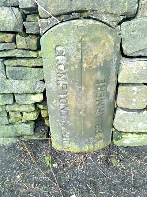
Image: © Milestone Society Taken: 30 Jan 2012
County Boundary Marker by the A672, at Grains Bar, 20 metres Northeast of crossroads, set in wall, West side of road. On the boundary of Crompton parish and Local Board of Health, Lancashire, now Shaw and Crompton parish, Oldham, and Friarmere, Saddleworth parish, West Riding, now Oldham. Inscription reads CROMPTON LOCAL BOARD and FRIARMERE, both vertically and separated by a vertical line. Surveyed Milestone Society National ID: LA_CROFRI01cb
Images are licensed for reuse under creativecommons.org/licenses/by-sa/2.0
Image Location
Latitude
53.573907
Longitude
-2.0578