Old Boundary Marker by the A420, London Road, Wick
Introduction
The photograph on this page of Old Boundary Marker by the A420, London Road, Wick by Milestone Society as part of the Geograph project.
The Geograph project started in 2005 with the aim of publishing, organising and preserving representative images for every square kilometre of Great Britain, Ireland and the Isle of Man.

There are currently over 7.5m images from over 14,400 individuals and you can help contribute to the project by visiting https://www.geograph.org.uk
Old Boundary Marker by the A420, London Road, Wick
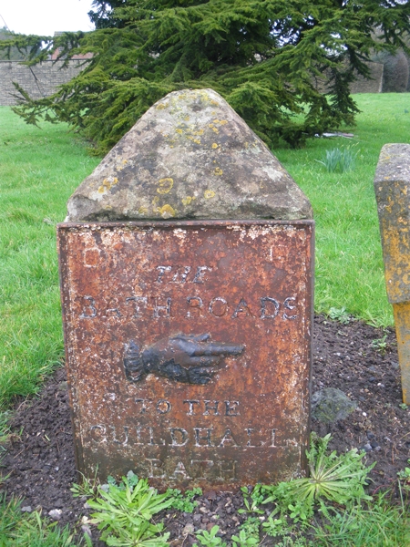
Image: © Milestone Society Taken: Unknown
Turnpike Terminus Marker by the UC road, in parish of Wick and Abson (South Gloucestershire District), London Road, Wick, opposite junction with Bath Road, on green. Inscription reads:- THE BATH ROADS {HAND->} TO THE GUILDHALL BATH (5¾) Carved bench mark on West face. Grade II listed. List Entry Number: 1216416 https://historicengland.org.uk/listing/the-list/list-entry/1216416 Surveyed Milestone Society National ID: GL_BAWK05t
Images are licensed for reuse under creativecommons.org/licenses/by-sa/2.0
Image Location
Latitude
51.452346
Longitude
-2.418404