Old Boundary Marker by the A635, Barnsley Road, Denby Dale
Introduction
The photograph on this page of Old Boundary Marker by the A635, Barnsley Road, Denby Dale by Milestone Society as part of the Geograph project.
The Geograph project started in 2005 with the aim of publishing, organising and preserving representative images for every square kilometre of Great Britain, Ireland and the Isle of Man.

There are currently over 7.5m images from over 14,400 individuals and you can help contribute to the project by visiting https://www.geograph.org.uk
Old Boundary Marker by the A635, Barnsley Road, Denby Dale
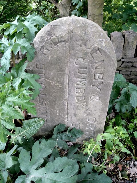
Image: © Milestone Society Taken: Unknown
Municipal Boundary Marker by the A635, in parish of Denby Dale (Kirklees District), between Denby Dale and Cawthorne close to County Boundary, next to 'Kirklees' signpost. Inscription reads:- : PENISTONE R.D. : : DENBY & / CUMBERWORTH / U.D. : To be surveyed Milestone Society National ID: YW_DEN0pb
Images are licensed for reuse under creativecommons.org/licenses/by-sa/2.0
Image Location


Leaflet Map data © OpenStreetMap
Latitude
53.563426
Longitude
-1.615786