Godwinscroft Signpost
Introduction
The photograph on this page of Godwinscroft Signpost by Nigel Mykura as part of the Geograph project.
The Geograph project started in 2005 with the aim of publishing, organising and preserving representative images for every square kilometre of Great Britain, Ireland and the Isle of Man.

There are currently over 7.5m images from over 14,400 individuals and you can help contribute to the project by visiting https://www.geograph.org.uk
Godwinscroft Signpost
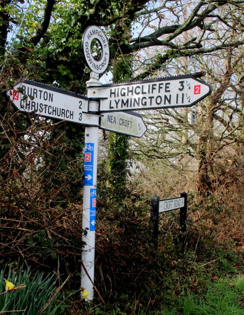
Image: © Nigel Mykura Taken: 6 Mar 2019
This finger post at the junction of Lyndhurst Rd and Croft Rd points the routes to Highcliffe, Lymington, Burton, Christchurch and Nea Croft. On old maps it is also spelt Nea Croft but on new maps it is Neacroft. On the old maps Godwinscroft is spelt Godwin's Croft. The boards and signpost also have stickers indicating that it is on National Cycle Route 2. The signpost appears to be made of cast iron and the finger boards each have a serrated top edge which is not sharp enough to deter perching birds but may stop hooligans swinging on them.
Images are licensed for reuse under creativecommons.org/licenses/by-sa/2.0
Image Location
Latitude
50.767428
Longitude
-1.735491