Westminster from the air
Introduction
The photograph on this page of Westminster from the air by Thomas Nugent as part of the Geograph project.
The Geograph project started in 2005 with the aim of publishing, organising and preserving representative images for every square kilometre of Great Britain, Ireland and the Isle of Man.

There are currently over 7.5m images from over 14,400 individuals and you can help contribute to the project by visiting https://www.geograph.org.uk
Westminster from the air
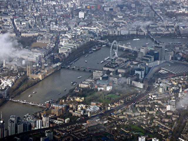
Image: © Thomas Nugent Taken: 28 Feb 2019
Archbishop's Park and St Thomas Hospital can be seen on the south bank of the Thames, with the Palace of Westminster, London Eye and Waterloo railway station also prominent. The Thames bridges are (left to right) Lambeth, Westminster, Hungerford with Golden Jubilee bridges and Waterloo Bridge.
Images are licensed for reuse under creativecommons.org/licenses/by-sa/2.0
Image Location
Latitude
51.493988
Longitude
-0.115798