Bench Mark, London
Introduction
The photograph on this page of Bench Mark, London by Rossographer as part of the Geograph project.
The Geograph project started in 2005 with the aim of publishing, organising and preserving representative images for every square kilometre of Great Britain, Ireland and the Isle of Man.

There are currently over 7.5m images from over 14,400 individuals and you can help contribute to the project by visiting https://www.geograph.org.uk
Bench Mark, London
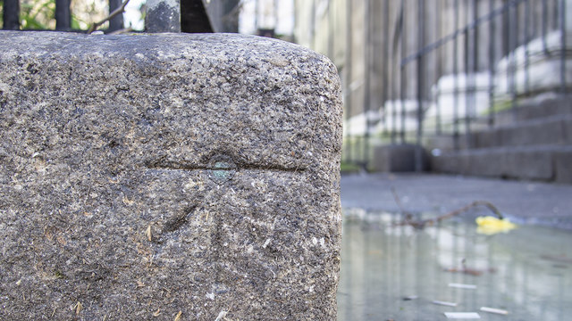
Image: © Rossographer Taken: 19 Feb 2019
Bench mark on the front of the surrounding wall at St Pancras Parish Church, London Image It consists of a cut mark with a copper bolt driven into the front wall and dates from the 1st geodetic levelling of England & Wales (1840-60). See log at https://www.bench-marks.org.uk/bm34627 .
Images are licensed for reuse under creativecommons.org/licenses/by-sa/2.0
Image Location
Latitude
51.527137
Longitude
-0.130577