Old circular AA Sign on Stawell Road in Stawell
Introduction
The photograph on this page of Old circular AA Sign on Stawell Road in Stawell by Milestone Society as part of the Geograph project.
The Geograph project started in 2005 with the aim of publishing, organising and preserving representative images for every square kilometre of Great Britain, Ireland and the Isle of Man.

There are currently over 7.5m images from over 14,400 individuals and you can help contribute to the project by visiting https://www.geograph.org.uk
Old circular AA Sign on Stawell Road in Stawell
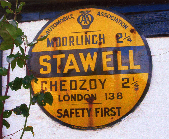
Image: © Milestone Society Taken: Unknown
Old AA Sign on the north facing wall of the Old Post Office, a house on Stawell Road in Stawell, 5 miles east of Bridgwater. Stawell parish. This is the circular, village name on black band, no Motor Union symbol or name type, dating to 1923 and showing distances Moorlinch 2¼ Chedzoy 2¼ London 138. There were five series of AA signs, mostly dating from 1923 and made by Francis & Co / Franco in Deptford, London. The village name and distance to London were usually displayed. See also https://3.bp.blogspot.com/-q8fQXpnLIFE/WooB1mKDiYI/AAAAAAAAWZ4/zB6_RyB7tYIT7gbllifaW-BvFXlVvlE5wCKgBGAs/s1600/DSCN6615.JPG. Milestone Society National ID: SO-STAW
Images are licensed for reuse under creativecommons.org/licenses/by-sa/2.0
Image Location
Latitude
51.140609
Longitude
-2.907985