Former Wadebridge Tollhouse, Whitecross Road, St Breock
Introduction
The photograph on this page of Former Wadebridge Tollhouse, Whitecross Road, St Breock by Alan Rosevear as part of the Geograph project.
The Geograph project started in 2005 with the aim of publishing, organising and preserving representative images for every square kilometre of Great Britain, Ireland and the Isle of Man.

There are currently over 7.5m images from over 14,400 individuals and you can help contribute to the project by visiting https://www.geograph.org.uk
Former Wadebridge Tollhouse, Whitecross Road, St Breock
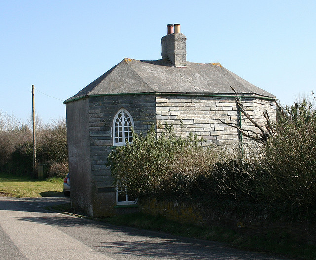
Image: © Alan Rosevear Taken: 19 Dec 2007
Tollhouse by the unclassified road (was A39), in the parish of St Breock (North Cornwall District), Tollgate House (the Roundhouse), Whitecross Road, PL27 7HT. Grade II listed. List Entry Number: 1310957 https://historicengland.org.uk/listing/the-list/list-entry/1310957 Surveyed Milestone Society National ID: CW.STB
Images are licensed for reuse under creativecommons.org/licenses/by-sa/2.0
Image Location
Latitude
50.517798
Longitude
-4.862347