Old milemarker north of Brewood Bridge
Introduction
The photograph on this page of Old milemarker north of Brewood Bridge by Milestone Society as part of the Geograph project.
The Geograph project started in 2005 with the aim of publishing, organising and preserving representative images for every square kilometre of Great Britain, Ireland and the Isle of Man.

There are currently over 7.5m images from over 14,400 individuals and you can help contribute to the project by visiting https://www.geograph.org.uk
Old milemarker north of Brewood Bridge
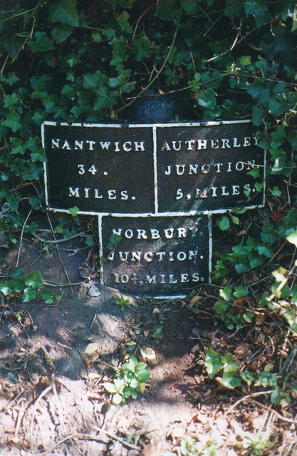
Image: © Milestone Society Taken: Unknown
Milemarker by the Shropshire Union Canal, in parish of Brewood (South Staffordshire District), North of Brewood Bridge. Inscription reads:- :NANTWICH/34./MILES.: :NORBURY./JUNCTION./10½,MILES.: :AUTHERLEY./JUNCTION./5.MILES: Grade II listed. List Entry Number: 1374012 https://historicengland.org.uk/listing/the-list/list-entry/1374012 Surveyed Milestone Society National ID: SUC-05
Images are licensed for reuse under creativecommons.org/licenses/by-sa/2.0
Image Location
Latitude
52.677872
Longitude
-2.178952