Old Boundary Marker by the A644, Brighouse and Denholme Road, Queensbury parish
Introduction
The photograph on this page of Old Boundary Marker by the A644, Brighouse and Denholme Road, Queensbury parish by Milestone Society as part of the Geograph project.
The Geograph project started in 2005 with the aim of publishing, organising and preserving representative images for every square kilometre of Great Britain, Ireland and the Isle of Man.

There are currently over 7.5m images from over 14,400 individuals and you can help contribute to the project by visiting https://www.geograph.org.uk
Old Boundary Marker by the A644, Brighouse and Denholme Road, Queensbury parish
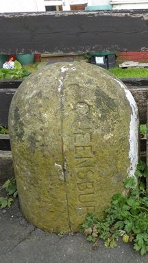
Image: © Milestone Society Taken: Unknown
Parish Boundary Marker by the A644, in parish of Queensbury (Bradford District), Brighouse and Denholme Road, Mountain, on pavement, against wall of No.45, next to YW_QUEE05pb Image Surveyed Milestone Society National ID: YW_QUEE04pb
Images are licensed for reuse under creativecommons.org/licenses/by-sa/2.0
Image Location
Latitude
53.77449
Longitude
-1.859792