Old Boundary Marker by Faringdon Road, Kingston Bagpuize
Introduction
The photograph on this page of Old Boundary Marker by Faringdon Road, Kingston Bagpuize by Milestone Society as part of the Geograph project.
The Geograph project started in 2005 with the aim of publishing, organising and preserving representative images for every square kilometre of Great Britain, Ireland and the Isle of Man.

There are currently over 7.5m images from over 14,400 individuals and you can help contribute to the project by visiting https://www.geograph.org.uk
Old Boundary Marker by Faringdon Road, Kingston Bagpuize
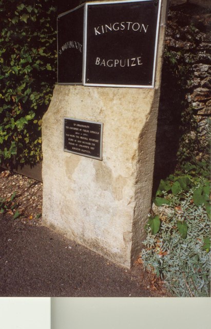
Image: © Milestone Society Taken: Unknown
Parish Boundary Marker by the UC road, in parish of Kingston Bagpuize with Southmoor (Vale of White Horse District), Faringdon Road; at Boundary with Southmoor, beside footpath against stone garden wall, North side of road. Out of place - in public view Inscription reads:- : SOUTHMOOR : : KINGSTON / BAGPUIZE : Milestone Society National ID: BE_LG67pb
Images are licensed for reuse under creativecommons.org/licenses/by-sa/2.0
Image Location
Latitude
51.681099
Longitude
-1.417069