Old Boundary Marker by the A2207, Crucifix Lane
Introduction
The photograph on this page of Old Boundary Marker by the A2207, Crucifix Lane by Milestone Society as part of the Geograph project.
The Geograph project started in 2005 with the aim of publishing, organising and preserving representative images for every square kilometre of Great Britain, Ireland and the Isle of Man.

There are currently over 7.5m images from over 14,400 individuals and you can help contribute to the project by visiting https://www.geograph.org.uk
Old Boundary Marker by the A2207, Crucifix Lane
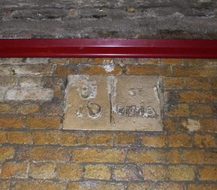
Image: © Milestone Society Taken: Unknown
Parish Boundary Marker by the A2207, in parish of Bermondsey Rotherhithe and Southwark (Southwark District), Crucifix Lane SE1, under railway arch, high up, Southeast side of road. Surveyed Milestone Society National ID: SY_SJSSMMB03pb
Images are licensed for reuse under creativecommons.org/licenses/by-sa/2.0
Image Location
Latitude
51.502062
Longitude
-0.080265