Old Direction Sign - Signpost by High Cross Lane, Froxfield parish
Introduction
The photograph on this page of Old Direction Sign - Signpost by High Cross Lane, Froxfield parish by Milestone Society as part of the Geograph project.
The Geograph project started in 2005 with the aim of publishing, organising and preserving representative images for every square kilometre of Great Britain, Ireland and the Isle of Man.

There are currently over 7.5m images from over 14,400 individuals and you can help contribute to the project by visiting https://www.geograph.org.uk
Old Direction Sign - Signpost by High Cross Lane, Froxfield parish
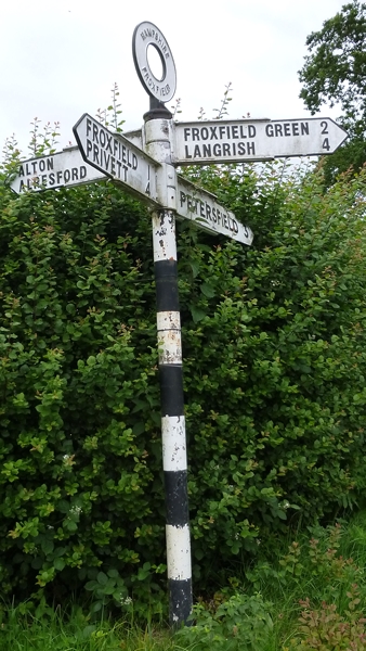
Image: © Milestone Society Taken: Unknown
Annulus finial - 4 arms; Hampshire Parish halo by the UC road, in parish of Froxfield (East Hampshire District), High Cross Lane junction with Petersfield Road, opposite Stoner Hill Lane. Surveyed Milestone Society National ID: HA_SU7226A
Images are licensed for reuse under creativecommons.org/licenses/by-sa/2.0
Image Location


Leaflet Map data © OpenStreetMap
Latitude
51.035292
Longitude
-0.965002