Old Boundary Marker by the A3022, New Road, Brixham parish
Introduction
The photograph on this page of Old Boundary Marker by the A3022, New Road, Brixham parish by Alan Rosevear as part of the Geograph project.
The Geograph project started in 2005 with the aim of publishing, organising and preserving representative images for every square kilometre of Great Britain, Ireland and the Isle of Man.

There are currently over 7.5m images from over 14,400 individuals and you can help contribute to the project by visiting https://www.geograph.org.uk
Old Boundary Marker by the A3022, New Road, Brixham parish
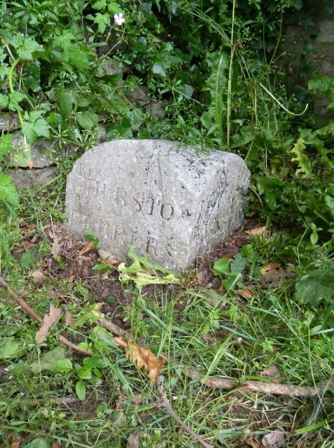
Image: © Alan Rosevear Taken: 4 Jun 2012
Parish Boundary Marker by the A3022, in parish of Brixham (Torbay District), opposite Laywell road, beside Brixham sign, on mudbank, by wall, just down from old gateway, North side of road. Inscription reads:- : CHURSTON / FERRERS : : (BRIXHAM?) : Surveyed Milestone Society National ID: DV_TQKW05pb
Images are licensed for reuse under creativecommons.org/licenses/by-sa/2.0
Image Location
Latitude
50.388885
Longitude
-3.533796