Old Mileplate by the B2260, Quarry Hill Road, Tonbridge
Introduction
The photograph on this page of Old Mileplate by the B2260, Quarry Hill Road, Tonbridge by C Woodward as part of the Geograph project.
The Geograph project started in 2005 with the aim of publishing, organising and preserving representative images for every square kilometre of Great Britain, Ireland and the Isle of Man.

There are currently over 7.5m images from over 14,400 individuals and you can help contribute to the project by visiting https://www.geograph.org.uk
Old Mileplate by the B2260, Quarry Hill Road, Tonbridge
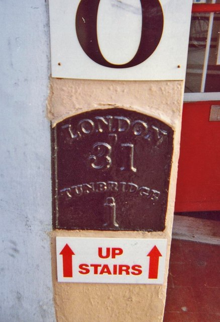
Image: © C Woodward Taken: 23 Jan 2007
Metal plate detached from post by the B2260, in parish of TONBRIDGE (TONBRIDGE AND MALLING District), Quarry Hill Road, close to North of Pembury Road, in wall of Beat N Track shop, in pilaster of shop front, on East side of road. Tunbridge Iron plate, erected by the Tonbridge turnpike trust in the 19th century. Inscription reads:- LONDON 31 TUNBRIDGE 1 Kent HER. HER Number: TQ 54 NE 11 https://www.heritagegateway.org.uk/Gateway/Results_Single.aspx?uid=MKE97759&resourceID=1005 Milestone Society National ID: KE_LR31
Images are licensed for reuse under creativecommons.org/licenses/by-sa/2.0
Image Location
Latitude
51.190117
Longitude
0.269922