Whitson parish church
Introduction
The photograph on this page of Whitson parish church by Robin Drayton as part of the Geograph project.
The Geograph project started in 2005 with the aim of publishing, organising and preserving representative images for every square kilometre of Great Britain, Ireland and the Isle of Man.

There are currently over 7.5m images from over 14,400 individuals and you can help contribute to the project by visiting https://www.geograph.org.uk
Whitson parish church
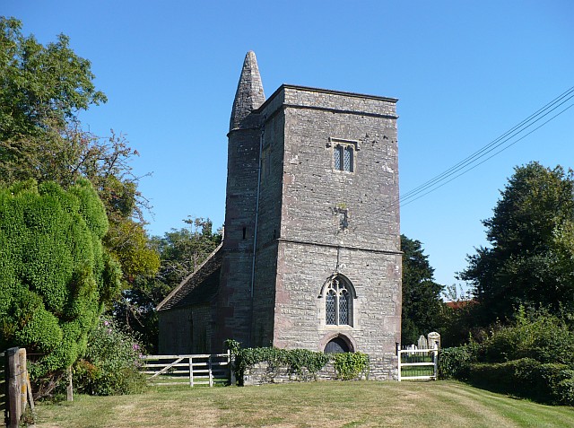
Image: © Robin Drayton Taken: 15 Sep 2007
Guide books state that this church has no dedication, but recent references give it as St Mary's. Although now no longer in use, there are some recent burials in the churchyard. The tilting tower is said to be due to 'the pull of the sea'. For some historical information on the Parish of Whitson see http://freepages.genealogy.rootsweb.com/~familyalbum/kwhitson.htm .
Images are licensed for reuse under creativecommons.org/licenses/by-sa/2.0
Image Location
Latitude
51.54635
Longitude
-2.894337