Methodist Chapel, Stottesdon, Shropshire
Introduction
The photograph on this page of Methodist Chapel, Stottesdon, Shropshire by Roger D Kidd as part of the Geograph project.
The Geograph project started in 2005 with the aim of publishing, organising and preserving representative images for every square kilometre of Great Britain, Ireland and the Isle of Man.

There are currently over 7.5m images from over 14,400 individuals and you can help contribute to the project by visiting https://www.geograph.org.uk
Methodist Chapel, Stottesdon, Shropshire
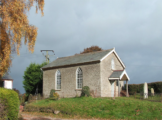
Image: © Roger D Kidd Taken: 6 Nov 2007
This quaint little chapel, built around 1858 (?), is precisely on the grid line (according to the OS 1:25000 maps)
Images are licensed for reuse under creativecommons.org/licenses/by-sa/2.0
Image Location
Latitude
52.443421
Longitude
-2.486921