Old Boundary Marker on Roman Road
Introduction
The photograph on this page of Old Boundary Marker on Roman Road by Milestone Society as part of the Geograph project.
The Geograph project started in 2005 with the aim of publishing, organising and preserving representative images for every square kilometre of Great Britain, Ireland and the Isle of Man.

There are currently over 7.5m images from over 14,400 individuals and you can help contribute to the project by visiting https://www.geograph.org.uk
Old Boundary Marker on Roman Road
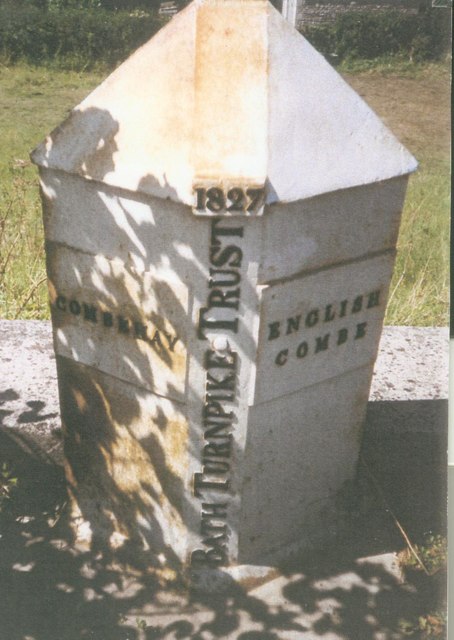
Image: © Milestone Society Taken: 4 Aug 2002
Turnpike Parish Boundary Marker on the northwest side of the A367 Roman Road northeast of the roundabout at the entrance to the Odd Down Park and Ride. In the parish of Combe Hay (Bath and North East Somerset District). Inscription reads:- : COMBEHAY : : 1827 / BATH TURNPIKE TRUST : : ENGLISH / COMBE : Grade II listed. List Entry Number: 1313025 https://historicengland.org.uk/listing/the-list/list-entry/1313025 Surveyed Milestone Society National ID: SO_BARA02pb
Images are licensed for reuse under creativecommons.org/licenses/by-sa/2.0
Image Location
Latitude
51.353817
Longitude
-2.383672