Old Milestone by the A27, east of Glebe Farm, Sherfield English parish
Introduction
The photograph on this page of Old Milestone by the A27, east of Glebe Farm, Sherfield English parish by K Lawrence as part of the Geograph project.
The Geograph project started in 2005 with the aim of publishing, organising and preserving representative images for every square kilometre of Great Britain, Ireland and the Isle of Man.

There are currently over 7.5m images from over 14,400 individuals and you can help contribute to the project by visiting https://www.geograph.org.uk
Old Milestone by the A27, east of Glebe Farm, Sherfield English parish
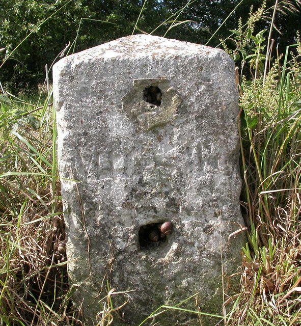
Image: © K Lawrence Taken: 24 Oct 2002
Stone post (plate lost) by the A27, in parish of SHERFIELD ENGLISH (TEST VALLEY District), East of Glebe Farm, junction with Branches Lane, on the verge, on North side of road. Romsey tombstone marker, erected by the Whiteparish, Romsey & Southampton turnpike trust in the 19th century. Part inscription reads:- MILES TO ROMSEY Original Inscription once read:- (Salisbury) (11) (Romsey) (4) Milestone Society National ID: HA_ROSA04.
Images are licensed for reuse under creativecommons.org/licenses/by-sa/2.0
Image Location
Latitude
51.001603
Longitude
-1.575004