Beckets, Woodnesborough Lane
Introduction
The photograph on this page of Beckets, Woodnesborough Lane by John Baker as part of the Geograph project.
The Geograph project started in 2005 with the aim of publishing, organising and preserving representative images for every square kilometre of Great Britain, Ireland and the Isle of Man.

There are currently over 7.5m images from over 14,400 individuals and you can help contribute to the project by visiting https://www.geograph.org.uk
Beckets, Woodnesborough Lane
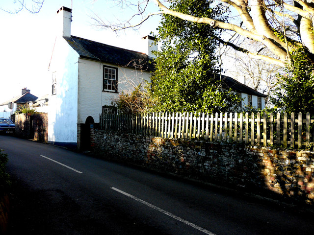
Image: © John Baker Taken: 3 Feb 2019
Planning permission has been granted by Dover District Council under application number DOV/18/00856 for “demolition of chimney and creation of new external opening. Insertion of glazed doors”. The house is grade II listed. It was built around the 17th century, extended and altered in the early 19th century https://britishlistedbuildings.co.uk/101070192-beckets-eastry#.XGMVEP43bcc
Images are licensed for reuse under creativecommons.org/licenses/by-sa/2.0
Image Location
Latitude
51.24785
Longitude
1.307315