Old Boundary Marker by the A214, Crown Lane, Streatham parish
Introduction
The photograph on this page of Old Boundary Marker by the A214, Crown Lane, Streatham parish by Milestone Society as part of the Geograph project.
The Geograph project started in 2005 with the aim of publishing, organising and preserving representative images for every square kilometre of Great Britain, Ireland and the Isle of Man.

There are currently over 7.5m images from over 14,400 individuals and you can help contribute to the project by visiting https://www.geograph.org.uk
Old Boundary Marker by the A214, Crown Lane, Streatham parish
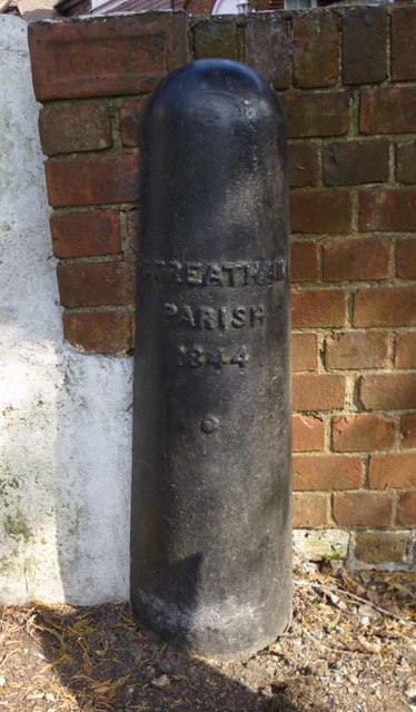
Image: © Milestone Society Taken: Unknown
Parish Boundary Marker by the A214, in parish of Streatham (Lambeth District), Streatham Common North Side SW16, at junction with Crown Lane against wall of No 55a next to Boundary Stone: SY_CROY02pb Image Inscription reads:- STREATHAM PARISH 1844 Surveyed Milestone Society National ID: SY_STRE02pb
Images are licensed for reuse under creativecommons.org/licenses/by-sa/2.0
Image Location
Latitude
51.423158
Longitude
-0.112758