Old Boundary Marker by Torrington Park, Finchley Parish
Introduction
The photograph on this page of Old Boundary Marker by Torrington Park, Finchley Parish by Milestone Society as part of the Geograph project.
The Geograph project started in 2005 with the aim of publishing, organising and preserving representative images for every square kilometre of Great Britain, Ireland and the Isle of Man.

There are currently over 7.5m images from over 14,400 individuals and you can help contribute to the project by visiting https://www.geograph.org.uk
Old Boundary Marker by Torrington Park, Finchley Parish
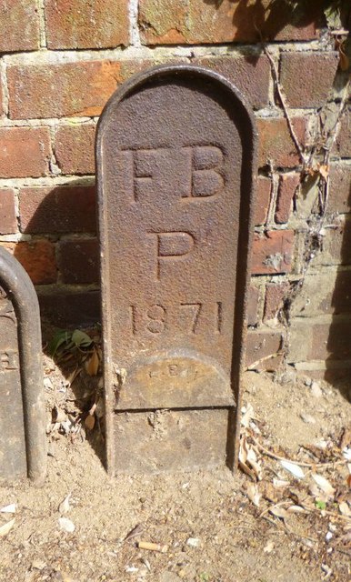
Image: © Milestone Society Taken: Unknown
Parish Boundary Marker by the UC road, in parish of Finchley (Barnet District), Woodhouse Road N12, Next to No 44, by stench pipe and letterbox against modern wall. Adjacent to: MX_FINC01pb Image Inscription reads:- FB P 1871 Surveyed Milestone Society National ID: MX_FBAR01pb
Images are licensed for reuse under creativecommons.org/licenses/by-sa/2.0
Image Location
Latitude
51.617113
Longitude
-0.172137