Old Milestone by Whins Lane, Wheelton parish
Introduction
The photograph on this page of Old Milestone by Whins Lane, Wheelton parish by J Higgins as part of the Geograph project.
The Geograph project started in 2005 with the aim of publishing, organising and preserving representative images for every square kilometre of Great Britain, Ireland and the Isle of Man.

There are currently over 7.5m images from over 14,400 individuals and you can help contribute to the project by visiting https://www.geograph.org.uk
Old Milestone by Whins Lane, Wheelton parish
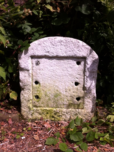
Image: © J Higgins Taken: 1 Oct 2008
Stone post (plate lost) by Whins Lane, the former A674, in parish of WHEELTON (CHORLEY District), near Pyebank House, in undergrowth, on East side of road. Chorley plate, erected by the Chorley to Blackburn turnpike trust in the 19th century. Inscription once read:- (TO) (CHORLEY) (3 MILES) (TO) (BLACKBURN) (6¾ MILES) (WHEELTON) Milestone Society National ID: LA_CYBB03.
Images are licensed for reuse under creativecommons.org/licenses/by-sa/2.0
Image Location
Latitude
53.689069
Longitude
-2.604624