Old Milestone by the B4014, Tetbury Road, Brokenborough parish
Introduction
The photograph on this page of Old Milestone by the B4014, Tetbury Road, Brokenborough parish by M Faherty as part of the Geograph project.
The Geograph project started in 2005 with the aim of publishing, organising and preserving representative images for every square kilometre of Great Britain, Ireland and the Isle of Man.

There are currently over 7.5m images from over 14,400 individuals and you can help contribute to the project by visiting https://www.geograph.org.uk
Old Milestone by the B4014, Tetbury Road, Brokenborough parish
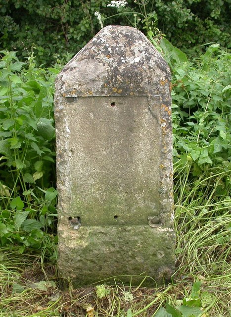
Image: © M Faherty Taken: 21 Jul 2007
Stone post (plate lost) by the B4014 (was A434), in parish of BROKENBOROUGH (NORTH WILTSHIRE District), Tetbury Road, top of Sunset Hill, 100m South of turning to Brokenborough, on verge, on West side of road. Malmesbury First marker, erected by the Malmesbury - First District turnpike trust in the 19th century. Inscription once read:- (TETBURY) (3) (MILES) (MALMESB.Y) (2) (MILES) Grade II listed. List Entry Number: 1198626 https://historicengland.org.uk/listing/the-list/list-entry/1198626 Milestone Society National ID: WI_MYTB02.
Images are licensed for reuse under creativecommons.org/licenses/by-sa/2.0
Image Location
Latitude
51.608705
Longitude
-2.114971