Old Bridge Marker by Plymbridge Road, Plymouth parish
Introduction
The photograph on this page of Old Bridge Marker by Plymbridge Road, Plymouth parish by Milestone Society as part of the Geograph project.
The Geograph project started in 2005 with the aim of publishing, organising and preserving representative images for every square kilometre of Great Britain, Ireland and the Isle of Man.

There are currently over 7.5m images from over 14,400 individuals and you can help contribute to the project by visiting https://www.geograph.org.uk
Old Bridge Marker by Plymbridge Road, Plymouth parish
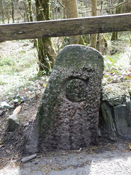
Image: © Milestone Society Taken: Unknown
Bridge Marker by the UC road, in parish of Plymouth (Plymouth District), 80m North of Plym Bridge, Eggbuckland, next to another 'C' stone Image in muddy verge below wooden fence, East side of road. Surveyed Milestone Society National ID: DV_PBES01abr
Images are licensed for reuse under creativecommons.org/licenses/by-sa/2.0
Image Location
Latitude
50.410407
Longitude
-4.078681