Stelling Minnis Windmill Information Board
Introduction
The photograph on this page of Stelling Minnis Windmill Information Board by John P Reeves as part of the Geograph project.
The Geograph project started in 2005 with the aim of publishing, organising and preserving representative images for every square kilometre of Great Britain, Ireland and the Isle of Man.

There are currently over 7.5m images from over 14,400 individuals and you can help contribute to the project by visiting https://www.geograph.org.uk
Stelling Minnis Windmill Information Board
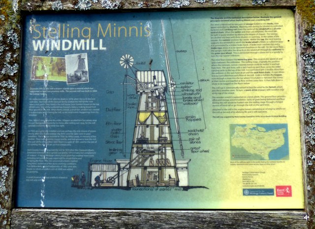
Image: © John P Reeves Taken: 2 Jun 2018
This Information Board gives some good detail on the Stelling Minnis Smock Mill (known as Davison's Mill), built in 1866 and working until 1970.
Images are licensed for reuse under creativecommons.org/licenses/by-sa/2.0
Image Location
Latitude
51.177254
Longitude
1.069288