A ruin on farmland near Dolgellau
Introduction
The photograph on this page of A ruin on farmland near Dolgellau by John Lucas as part of the Geograph project.
The Geograph project started in 2005 with the aim of publishing, organising and preserving representative images for every square kilometre of Great Britain, Ireland and the Isle of Man.

There are currently over 7.5m images from over 14,400 individuals and you can help contribute to the project by visiting https://www.geograph.org.uk
A ruin on farmland near Dolgellau
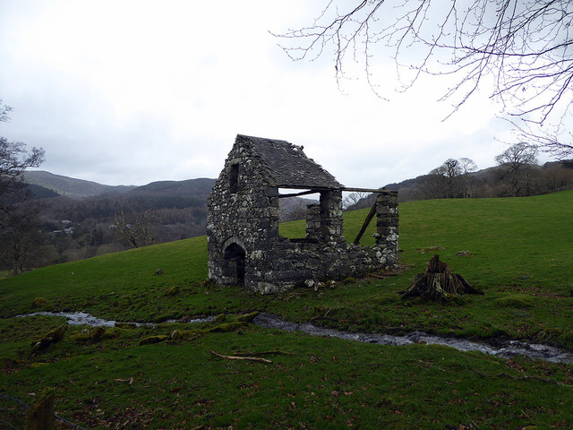
Image: © John Lucas Taken: 6 Feb 2019
The internet is quite shy about identifying it and its purpose. It is shown on early OS large scale maps but without description. Given the proximity of the stream it may well have been a water mill.
Images are licensed for reuse under creativecommons.org/licenses/by-sa/2.0
Image Location
Latitude
52.753416
Longitude
-3.897402