Old Boundary Marker by the A34, Cannock Road, Stafford parish
Introduction
The photograph on this page of Old Boundary Marker by the A34, Cannock Road, Stafford parish by M Faherty as part of the Geograph project.
The Geograph project started in 2005 with the aim of publishing, organising and preserving representative images for every square kilometre of Great Britain, Ireland and the Isle of Man.

There are currently over 7.5m images from over 14,400 individuals and you can help contribute to the project by visiting https://www.geograph.org.uk
Old Boundary Marker by the A34, Cannock Road, Stafford parish
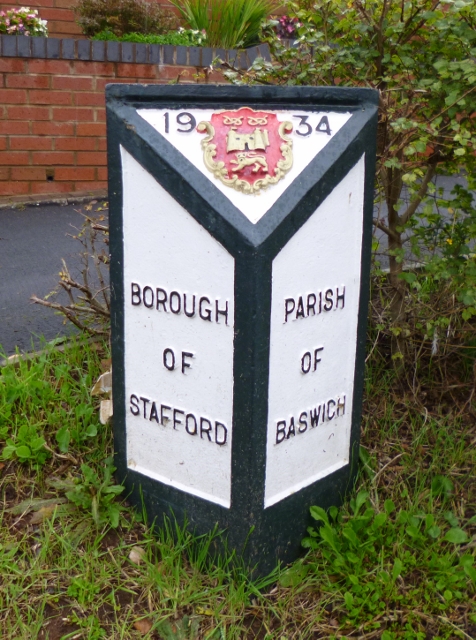
Image: © M Faherty Taken: 8 Oct 2012
Municipal Boundary Marker by the A34, on the former boundary of Stafford borough and Baswich parish, but is now in an unparished part of Stafford borough, Cannock Road, opposite service road, in front of path to bungalows. Inscription reads:- : BOROUGH / OF / STAFFORD : : 19{coat of arms}34 : : PARISH / OF / BASWICH : Surveyed Milestone Society National ID: ST_SFBW01pb
Images are licensed for reuse under creativecommons.org/licenses/by-sa/2.0
Image Location
Latitude
52.780589
Longitude
-2.077479