Old Milestone by old road, Dundry parish
Introduction
The photograph on this page of Old Milestone by old road, Dundry parish by JR Dowding as part of the Geograph project.
The Geograph project started in 2005 with the aim of publishing, organising and preserving representative images for every square kilometre of Great Britain, Ireland and the Isle of Man.

There are currently over 7.5m images from over 14,400 individuals and you can help contribute to the project by visiting https://www.geograph.org.uk
Old Milestone by old road, Dundry parish
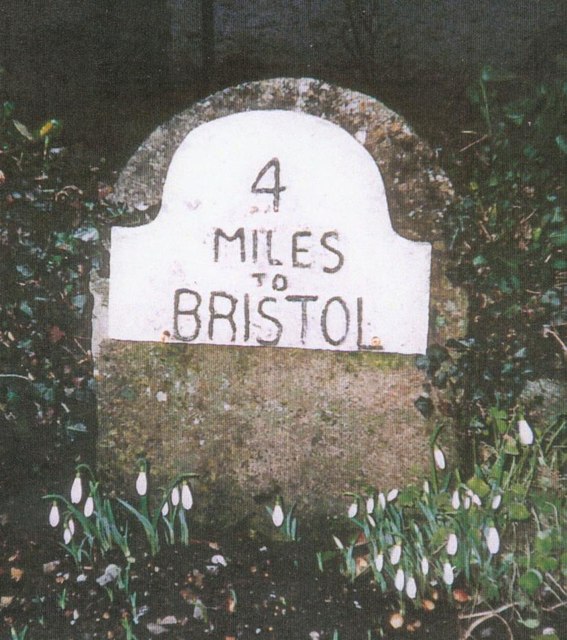
Image: © JR Dowding Taken: 18 Jan 2003
Metal plate attached to stone post by the UC road, in parish of DUNDRY (NORTH SOMERSET District), West side of triangle at Dundry to Bristol crossroads, on edge of garden on old road, on West side of road. Bristol iron plate, erected by the Bristol turnpike trust in the 19th century. Inscription reads:- 4 MILES TO BRISTOL Milestone Society National ID: SO_BRWL04.
Images are licensed for reuse under creativecommons.org/licenses/by-sa/2.0
Image Location


Leaflet Map data © OpenStreetMap
Latitude
51.396695
Longitude
-2.626503