Old Milestone by the A417, Corse, Staunton parish
Introduction
The photograph on this page of Old Milestone by the A417, Corse, Staunton parish by R Shackell as part of the Geograph project.
The Geograph project started in 2005 with the aim of publishing, organising and preserving representative images for every square kilometre of Great Britain, Ireland and the Isle of Man.

There are currently over 7.5m images from over 14,400 individuals and you can help contribute to the project by visiting https://www.geograph.org.uk
Old Milestone by the A417, Corse, Staunton parish
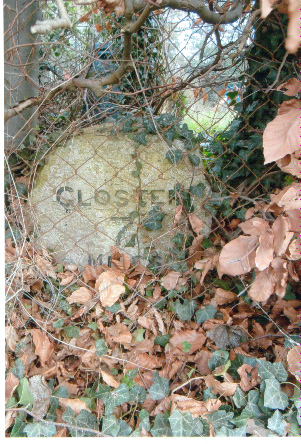
Image: © R Shackell Taken: 1 Mar 2014
Carved stone post by the A417, in parish of STAUNTON (FOREST OF DEAN District), Snig's End, behind garden wire fence in beech hedge, on East side of road. Maisemore marker, erected by the Maisemore (District of Hereford & Gloucester) turnpike trust in the 19th century. Inscription reads:- GLOSTER 7 MILES Milestone Society National ID: GL_GLLB07.
Images are licensed for reuse under creativecommons.org/licenses/by-sa/2.0
Image Location
Latitude
51.957201
Longitude
-2.304459