Old Milestone by the A3036, Wandsworth Road, Lambeth parish
Introduction
The photograph on this page of Old Milestone by the A3036, Wandsworth Road, Lambeth parish by L Joseph as part of the Geograph project.
The Geograph project started in 2005 with the aim of publishing, organising and preserving representative images for every square kilometre of Great Britain, Ireland and the Isle of Man.

There are currently over 7.5m images from over 14,400 individuals and you can help contribute to the project by visiting https://www.geograph.org.uk
Old Milestone by the A3036, Wandsworth Road, Lambeth parish
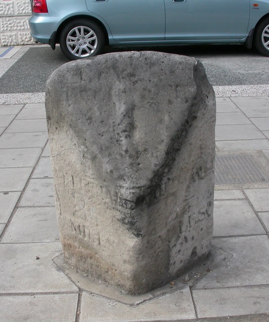
Image: © L Joseph Taken: 1 Mar 2005
Carved stone post by the A3036 (was A3), in parish of LAMBETH (LAMBETH District), Wandsworth Road SW8, by No. 374, 100m Southwest of Albion Avenue, in pavement, on North side of road. Surrey limestone pillar, erected by the Surrey & Sussex turnpike trust in the 18th century. Inscription reads:- : WHITEHALL / 2(¾) / MILES : : WHITEHALL / 2(¾) / MILES : Grade II listed. List Entry Number: 1081051 https://historicengland.org.uk/listing/the-list/list-entry/1081051 Milestone Society National ID: SY_LP02aa.
Images are licensed for reuse under creativecommons.org/licenses/by-sa/2.0
Image Location
Latitude
51.471203
Longitude
-0.137356