Old Boundary Marker by Old Dashwood Hill, Stokenchurch parish
Introduction
The photograph on this page of Old Boundary Marker by Old Dashwood Hill, Stokenchurch parish by Milestone Society as part of the Geograph project.
The Geograph project started in 2005 with the aim of publishing, organising and preserving representative images for every square kilometre of Great Britain, Ireland and the Isle of Man.

There are currently over 7.5m images from over 14,400 individuals and you can help contribute to the project by visiting https://www.geograph.org.uk
Old Boundary Marker by Old Dashwood Hill, Stokenchurch parish
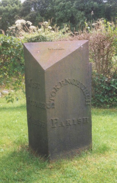
Image: © Milestone Society Taken: Unknown
Parish Boundary Marker by the UC road, in parish of Stokenchurch (Wycombe District), Old Dashwood Hill, Studley Green, outside last house on South end of village, on wide well cut lawn, South side of road. Inscription reads:- : WEST / WYCOMBE / PARISH : : STOKENCHURCH / PARISH : Maker:- : WILDER : Surveyed Milestone Society National ID: BU_LW33pb
Images are licensed for reuse under creativecommons.org/licenses/by-sa/2.0
Image Location
Latitude
51.647348
Longitude
-0.851341