Old Boundary Marker by Goodleigh Road, Goodleigh parish
Introduction
The photograph on this page of Old Boundary Marker by Goodleigh Road, Goodleigh parish by Alan Rosevear as part of the Geograph project.
The Geograph project started in 2005 with the aim of publishing, organising and preserving representative images for every square kilometre of Great Britain, Ireland and the Isle of Man.

There are currently over 7.5m images from over 14,400 individuals and you can help contribute to the project by visiting https://www.geograph.org.uk
Old Boundary Marker by Goodleigh Road, Goodleigh parish
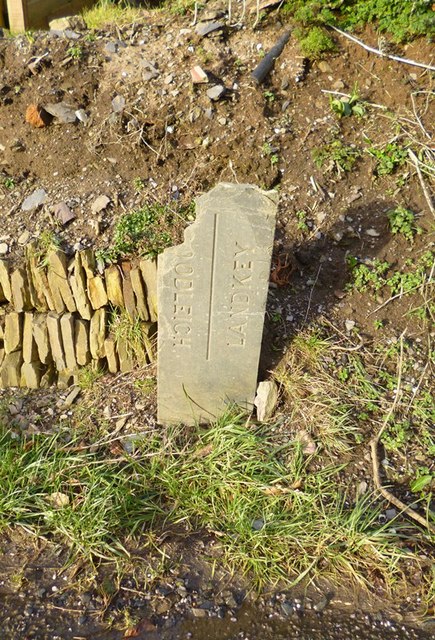
Image: © Alan Rosevear Taken: 8 Feb 2013
Parish Boundary Marker by the UC road, in parish of Goodleigh (North Devon District), Goodleigh Road, by No. 2 Dean Cottages, in garden bank by drive. Damaged. Inscription reads vertically:- : (GO)ODLEIGH : : LANDKEY : Surveyed Milestone Society National ID: DV_GDLK01pb
Images are licensed for reuse under creativecommons.org/licenses/by-sa/2.0
Image Location


Leaflet Map data © OpenStreetMap
Latitude
51.088611
Longitude
-3.984572