Old Milestone by the B1248, East Field Farm, Middleton parish
Introduction
The photograph on this page of Old Milestone by the B1248, East Field Farm, Middleton parish by J Harland as part of the Geograph project.
The Geograph project started in 2005 with the aim of publishing, organising and preserving representative images for every square kilometre of Great Britain, Ireland and the Isle of Man.

There are currently over 7.5m images from over 14,400 individuals and you can help contribute to the project by visiting https://www.geograph.org.uk
Old Milestone by the B1248, East Field Farm, Middleton parish
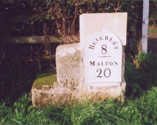
Image: © J Harland Taken: 1 Jun 2001
Modern metal plate attached to stone mounting block by the B1248, in parish of MIDDLETON (EAST RIDING OF YORKSHIRE District), by East Field Farm gateway, Middleton on the Wolds, on grass verge by telegraph pole, on West side of road. Beverley mounting block, 3 step (restored), erected by the Beverley to Kendale House turnpike trust in the 18th/19th century. Re-located from further North to next to farm entrance. Inscription reads:- BEVERLEY 8 ---- MALTON 20 Carved benchmark on right side. Grade II listed. List Entry Number: 1084150 https://historicengland.org.uk/listing/the-list/list-entry/1084150 Milestone Society National ID: YE_BVMA08.
Images are licensed for reuse under creativecommons.org/licenses/by-sa/2.0
Image Location
Latitude
53.93466
Longitude
-0.524195