Old Direction Sign - Signpost by Main Road, Crick parish
Introduction
The photograph on this page of Old Direction Sign - Signpost by Main Road, Crick parish by Milestone Society as part of the Geograph project.
The Geograph project started in 2005 with the aim of publishing, organising and preserving representative images for every square kilometre of Great Britain, Ireland and the Isle of Man.

There are currently over 7.5m images from over 14,400 individuals and you can help contribute to the project by visiting https://www.geograph.org.uk
Old Direction Sign - Signpost by Main Road, Crick parish
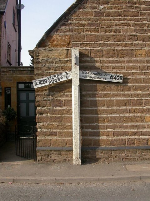
Image: © Milestone Society Taken: Unknown
No finial - 3 arms; Northants concrete by the UC road (was A428), in parish of Crick (Daventry District), opposite junction of Main Road with Church Street. (Now replaced with a modern post) Surveyed Milestone Society National ID: NR_SP5872
Images are licensed for reuse under creativecommons.org/licenses/by-sa/2.0
Image Location
Latitude
52.346653
Longitude
-1.136807