Old Boundary Marker by Nancealverne, Penzance parish
Introduction
The photograph on this page of Old Boundary Marker by Nancealverne, Penzance parish by Milestone Society as part of the Geograph project.
The Geograph project started in 2005 with the aim of publishing, organising and preserving representative images for every square kilometre of Great Britain, Ireland and the Isle of Man.

There are currently over 7.5m images from over 14,400 individuals and you can help contribute to the project by visiting https://www.geograph.org.uk
Old Boundary Marker by Nancealverne, Penzance parish
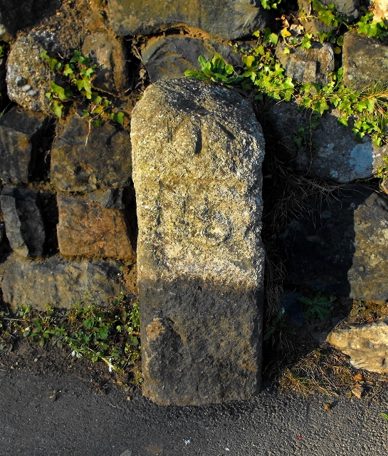
Image: © Milestone Society Taken: Unknown
Parish Boundary Marker by the UC road, in parish of Penzance (Penwith District), St Clare, opposite Fire Station, against wall of cricket ground, Northeast side of road. Inscription not legible. Large carved bench mark and rivet on top. Grade II listed. List Entry Number: 1408102 https://historicengland.org.uk/listing/the-list/list-entry/1408102 To be surveyed Milestone Society National ID: CW_PZMD01pb
Images are licensed for reuse under creativecommons.org/licenses/by-sa/2.0
Image Location
Latitude
50.123304
Longitude
-5.546315