Old Milestone by the B4368, Diddlebury parish
Introduction
The photograph on this page of Old Milestone by the B4368, Diddlebury parish by Mike Faherty as part of the Geograph project.
The Geograph project started in 2005 with the aim of publishing, organising and preserving representative images for every square kilometre of Great Britain, Ireland and the Isle of Man.

There are currently over 7.5m images from over 14,400 individuals and you can help contribute to the project by visiting https://www.geograph.org.uk
Old Milestone by the B4368, Diddlebury parish
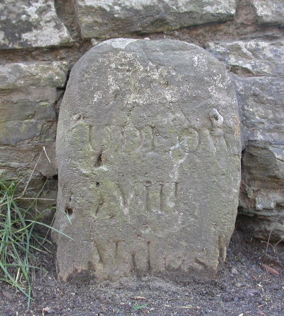
Image: © Mike Faherty Taken: 11 Feb 2008
Stone post (plate lost) by the B4368, in parish of DIDDLEBURY (SOUTH SHROPSHIRE District), by barn at Bache Mill House, partially inset into bridge wall, on South side of road. Ludlow stone, erected by the Ludlow (first district) turnpike trust in the 19th century. Inscription reads:- (L)UDLOW VIII Miles Shropshire HER. HER Number (PRN): 21194 https://www.heritagegateway.org.uk/Gateway/Results_Single.aspx?uid=MSA23824&resourceID=1015 Milestone Society National ID: SA_LDBN08
Images are licensed for reuse under creativecommons.org/licenses/by-sa/2.0
Image Location
Latitude
52.465926
Longitude
-2.732296