Old Boundary Marker by Burton Road, Camberwell parish
Introduction
The photograph on this page of Old Boundary Marker by Burton Road, Camberwell parish by Milestone Society as part of the Geograph project.
The Geograph project started in 2005 with the aim of publishing, organising and preserving representative images for every square kilometre of Great Britain, Ireland and the Isle of Man.

There are currently over 7.5m images from over 14,400 individuals and you can help contribute to the project by visiting https://www.geograph.org.uk
Old Boundary Marker by Burton Road, Camberwell parish
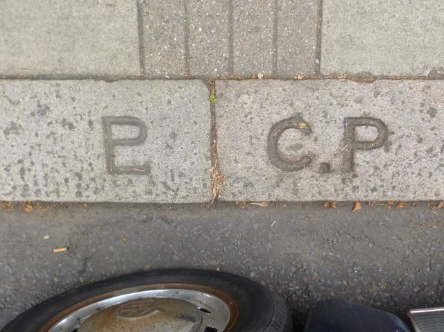
Image: © Milestone Society Taken: Unknown
Parish Boundary Marker by the UC road, in parish of Camberwell and Dulwich (Southwark District), Burton Road SW9, in front of No 111 near junction with Brief Street on kerb. Inscription on left reads:- LP (combined) (Lambeth Parish) Inscription on right reads:- C.P (Camberwell Parish) Surveyed Milestone Society National ID: SY_LAMB08pb Milestone Society National ID: SY_SGC19pb
Images are licensed for reuse under creativecommons.org/licenses/by-sa/2.0
Image Location
Latitude
51.472011
Longitude
-0.106394