Old Boundary Marker by the A659, Newton Kyme
Introduction
The photograph on this page of Old Boundary Marker by the A659, Newton Kyme by Milestone Society as part of the Geograph project.
The Geograph project started in 2005 with the aim of publishing, organising and preserving representative images for every square kilometre of Great Britain, Ireland and the Isle of Man.

There are currently over 7.5m images from over 14,400 individuals and you can help contribute to the project by visiting https://www.geograph.org.uk
Old Boundary Marker by the A659, Newton Kyme
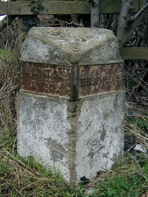
Image: © Milestone Society Taken: Unknown
Parish Boundary Marker by the A659, in parish of Newton Kyme cum Toulston (Selby District). Inscription reads:- : NEWTON / KYME : : BRAMHAM : Surveyed Milestone Society National ID: YW_TCOT02pb
Images are licensed for reuse under creativecommons.org/licenses/by-sa/2.0
Image Location
Latitude
53.896911
Longitude
-1.31786