Old Boundary Marker by Jewry Street, City of London
Introduction
The photograph on this page of Old Boundary Marker by Jewry Street, City of London by Milestone Society as part of the Geograph project.
The Geograph project started in 2005 with the aim of publishing, organising and preserving representative images for every square kilometre of Great Britain, Ireland and the Isle of Man.

There are currently over 7.5m images from over 14,400 individuals and you can help contribute to the project by visiting https://www.geograph.org.uk
Old Boundary Marker by Jewry Street, City of London
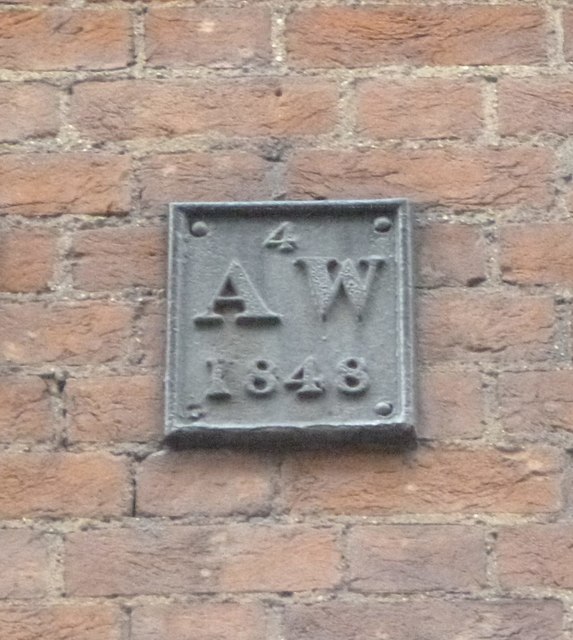
Image: © Milestone Society Taken: Unknown
Parish Boundary Marker by the UC road, in parish of City of London (City of London District), original location unknown, now high on wall of Northern extension, Sir John Cass's Foundation, Jewry Street EC3. Photo is just South of the Three Tuns, East side of road In between Boundary Markers: CL_SKC02pb Image and CL_WALD01pb Image Inscription reads:- 4 AW 1848 Out of place - in public view Milestone Society National ID: CL_WALD02pb
Images are licensed for reuse under creativecommons.org/licenses/by-sa/2.0
Image Location


Leaflet Map data © OpenStreetMap
Latitude
51.513198
Longitude
-0.076598