Old Milestone by the A41, Crickmery, Suton upon Tern parish
Introduction
The photograph on this page of Old Milestone by the A41, Crickmery, Suton upon Tern parish by A Reade/J Higgins as part of the Geograph project.
The Geograph project started in 2005 with the aim of publishing, organising and preserving representative images for every square kilometre of Great Britain, Ireland and the Isle of Man.

There are currently over 7.5m images from over 14,400 individuals and you can help contribute to the project by visiting https://www.geograph.org.uk
Old Milestone by the A41, Crickmery, Suton upon Tern parish
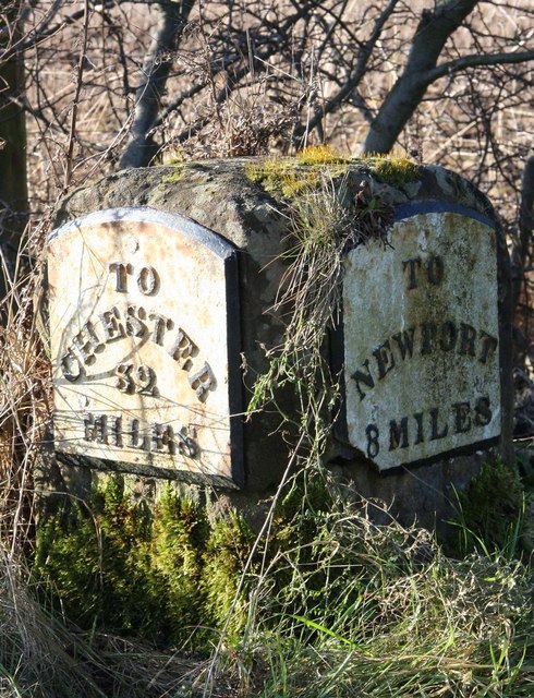
Image: © A Reade/J Higgins Taken: 1 Sep 2007
Metal plates attached to stone post by the A41, in parish of SUTTON UPON TERN (NORTH SHROPSHIRE District), Crickmery, Sweet Appletree opposite No. 5, on Southwest side of road. Chester road post, erected by the Newport & Ternhill turnpike trust in the 19th century. Inscription reads:- : TO / CHESTER / 32 / MILES : : TO / NEWPORT / 8 MILES : Grade II listed. List Entry Number: 1176653 https://historicengland.org.uk/listing/the-list/list-entry/1176653 Milestone Society National ID: SA_CHNP32.
Images are licensed for reuse under creativecommons.org/licenses/by-sa/2.0
Image Location
Latitude
52.856935
Longitude
-2.486608