Old Milestone by the A360, Devizes Road, Bemerton Heath
Introduction
The photograph on this page of Old Milestone by the A360, Devizes Road, Bemerton Heath by M Faherty as part of the Geograph project.
The Geograph project started in 2005 with the aim of publishing, organising and preserving representative images for every square kilometre of Great Britain, Ireland and the Isle of Man.

There are currently over 7.5m images from over 14,400 individuals and you can help contribute to the project by visiting https://www.geograph.org.uk
Old Milestone by the A360, Devizes Road, Bemerton Heath
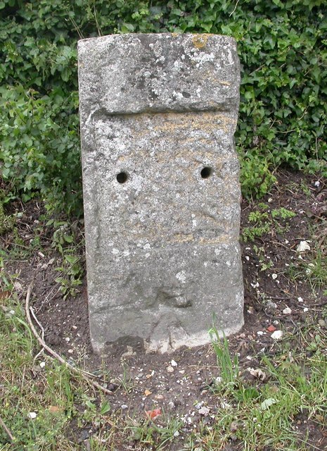
Image: © M Faherty Taken: 28 May 2007
Stone post (plate lost) by the A360, in parish of SALISBURY (SALISBURY District), Devizes Road, Bemerton Heath; 250m South of Fugglestone Red roundabout, on the verge, on West side of the A360 road. Salisbury plate, erected by the Fisherton, Wilton, Heytesbury, Willoughby Hedge & Redhone turnpike trust in the 19th century. Inscription once read:- (Salisbury) (2) (Devizes) (21) Carved benchmark lower front centre. Milestone Society National ID: WI_DZSA21.
Images are licensed for reuse under creativecommons.org/licenses/by-sa/2.0
Image Location
Latitude
51.088687
Longitude
-1.825472