Old Boundary Marker by the B1352, Main Road, Harwich
Introduction
The photograph on this page of Old Boundary Marker by the B1352, Main Road, Harwich by Milestone Society as part of the Geograph project.
The Geograph project started in 2005 with the aim of publishing, organising and preserving representative images for every square kilometre of Great Britain, Ireland and the Isle of Man.

There are currently over 7.5m images from over 14,400 individuals and you can help contribute to the project by visiting https://www.geograph.org.uk
Old Boundary Marker by the B1352, Main Road, Harwich
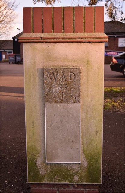
Image: © Milestone Society Taken: Unknown
Estate Boundary Marker - War Department by the B1352, in parish of Harwich (Tendring District), Main Road near junction with Barrack Road, inset into gatepost, West side of entrance. Inscription reads:- W^D BS 1 Surveyed Milestone Society National ID: EX_WDHAR01em
Images are licensed for reuse under creativecommons.org/licenses/by-sa/2.0
Image Location
Latitude
51.938718
Longitude
1.285455